

Медленно через Галилею: первые 48 часов на Тропе Иисуса
A practical Nazareth-to-Cana guide: water, views, daylight and what to do before or after the hike
Starting point
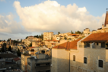
The Nazareth-to-Cana section of the Jesus Trail begins around the Old City and Basilica of the Annunciation. It is a linear route of roughly 14 km, so plan water, daylight and return logistics in advance.
Water and preparation
Water is available in Nazareth and villages along the route, but not continuously. In hot weather, carry enough water rather than relying on taps along every section.
Views and landscape
The route gradually opens from urban Nazareth into Lower Galilee scenery, olive groves and villages. An early start is usually the better choice.
Safety
Some sections pass near local roads and village streets. Follow the route markings, avoid walking after dark and check the latest Jesus Trail and GALIL.APP information before leaving.
Continue the route with local food
After the route, continue to Shaabi Nazareth, Tawfiq Ziad St 37. The branch is open daily 10:00 AM–4:00 AM.
- GALIL.APP — Shaabi Nazareth: local context and route discovery.
- SHAABI.CO.IL — official branch site: menu, hours and directions.
- SHAWARMA.WEBSITE: deeper shawarma guides and food content.
This turns the article into a complete visitor journey: attraction → local discovery → food.
מערכת GALIL.APP
Назарет — Места
Церковь Архангела Гавриила над источником
The 1750 Greek Orthodox church over Mary's spring — carved iconostasis and a crypt with running water.
 Часы не подтверждены
Old Nazareth Market
Alleys, spices, sweets and craft workshops in the Old City.
 Откроется сегодня в 06:00
Mount Precipice Lookout
Panoramic lookout over the Jezreel Valley and Mount Tabor.
Истории
Между источником и горой: пешком через Нижнюю Галилею
A practical field guide to the Jesus Trail, Nahal Tzipori and ancient Zippori

 Природа
Галилейский оливковый маршрут
A journey through the rolling hills and olive groves of Lower Galilee.